
NAVYX.
Nautical chart, marine weather, routes and safety in one app, for people who go to sea.
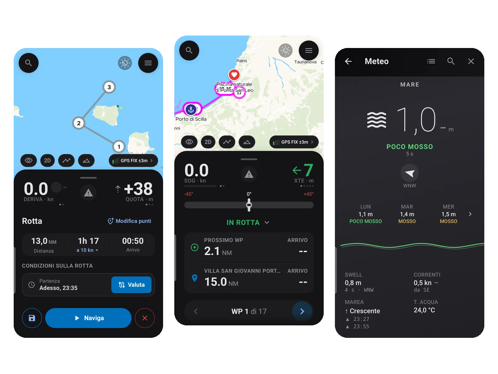
Gallery
What NAVYX does.
Nautical chart
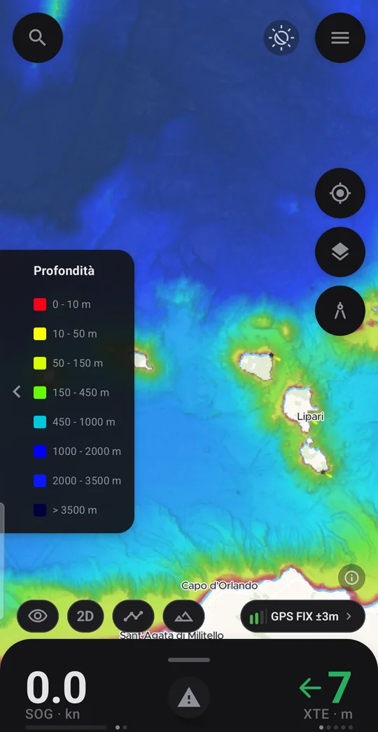
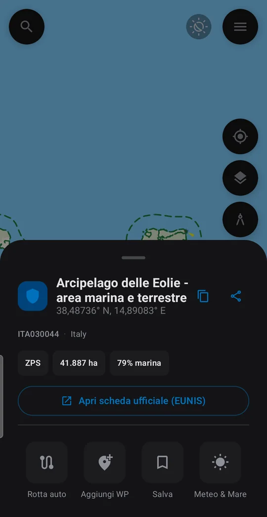
Seamarks, depths, seabed type and marine protected areas, with satellite view, customizable map themes and full screen.
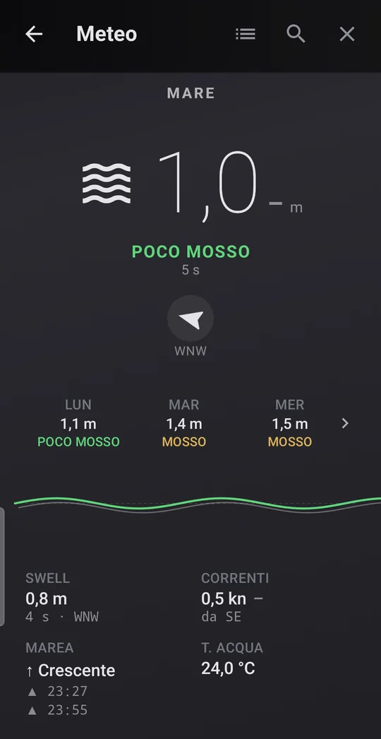
Marine weather
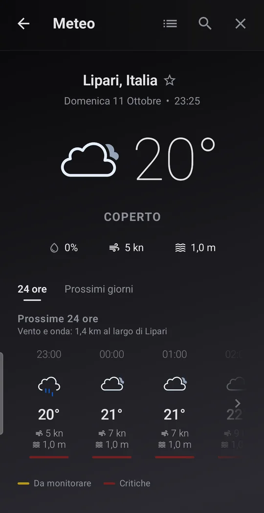
Wind, gusts, waves, currents, tides, water temperature and pressure, with a forecast for the next 3 days for any point on the map.
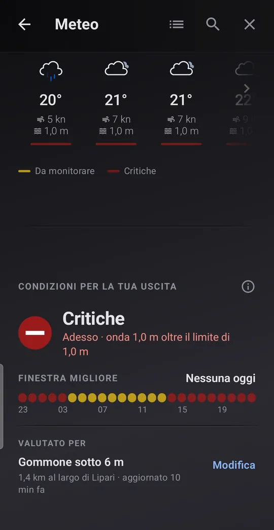
Conditions to go out
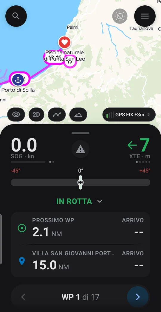
A simple color (favorable, watch, critical) for your boat and your area, with the best window of the day and the conditions along your route, leg by leg.
Routes and tracks
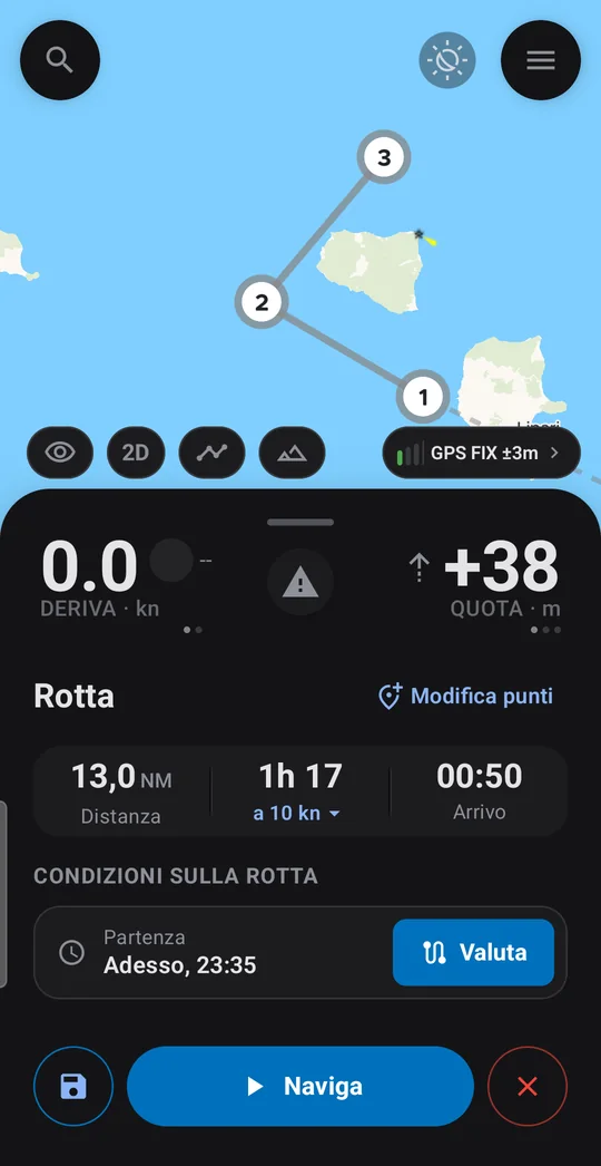
Routes in the Mediterranean and the Black Sea, calculated on the phone even offline, that go around the coast. Tracks with distance, duration and average speed.
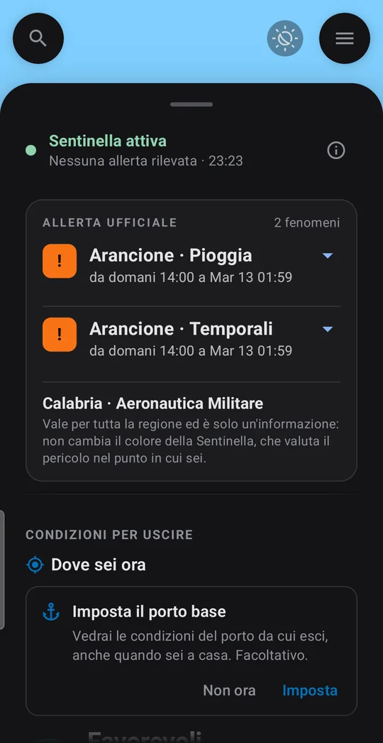
Weather Sentinel
While you are at sea or at anchor it checks the official MeteoAlarm warnings for your area, notifies you of orange and red levels and keeps the nearest shelter at hand.
Unlimited safety
Emergency SOS with your position ready to share, Man overboard, a quick call to the Coast Guard and an anchor alarm that sounds even with the screen off. Always free.
The details.
- 01
SOS always in sight
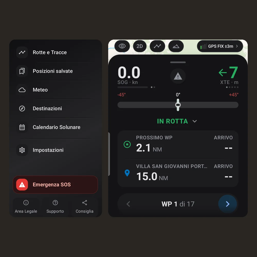
Emergency SOS sits at the bottom of the main menu, set apart from the other items and visible without scrolling. It also opens from the GPS position panel.
- 02
Accuracy on show
On the map, the GPS FIX pill shows how accurate your position is, in meters.
- 03
Made to be read on board
Navigation values in large figures, readable even when the boat is moving.
download
Free · Pro coming soon
Free with an account (Google or email), with no ads and no mandatory subscription. NAVYX Pro, with extra features, is planned for summer 2027 (date subject to change): safety features will always stay free.
requirements
- system
- Android 8.0 or later, smartphones only
- sensors
- GPS
- account
- free (Google or email), for weather and online features
- connection
- for weather, warnings and charts; routes are calculated even offline
- languages
- English, Italiano
privacy
No ads, minimal data.
- account
- Email or Google account, for weather and online features
- location
- Your precise location stays on the phone; for weather it is sent rounded to about 1 km
- routes and tracks
- Stay on your phone, with GPX export and import
- statistics and crashes
- Anonymous, can be turned off in the app settings
- deletion
- From the app, together with the account and the data stored on the server
What’s new
All versions- First public version, in beta on Google Play and open to everyone.
- Free with an account (Google or email), with no ads.
- Basic Sentinel: official MeteoAlarm weather warnings with a notification for orange and red levels.
- File backup: export routes and tracks as GPX and import them again.
Frequently asked questions
Is NAVYX really free?
Yes. All you need is a free account (Google or email), with no ads and no mandatory subscription. NAVYX Pro, planned for summer 2027, will add extra features; safety features will stay free.
Does it work offline?
Partly. Routes are calculated on the phone even offline. Weather, official warnings and charts come from the internet and need a connection.
Which seas are routes calculated for?
The Mediterranean and the Black Sea. Routes go around the coast instead of cutting across land.
What does public beta mean?
NAVYX is on Google Play and ready to use, but it is still being tested before the official release: some features may change. Reports help improve it.
Is it available for iPhone or tablets?
For now NAVYX is for Android smartphones only. Tablet and iOS versions are coming.
Does NAVYX replace official charts and instruments?
No. It is a navigation aid: it does not replace official nautical charts, official weather bulletins or the skipper’s judgment. Always check the conditions before going out.
Something wrong with NAVYX?
Every report gets read. Include the version and device if you can.